Urban · Modern
Platinum Triangle
Stadiums, rail lines, river trails, apartments, and former industrial blocks meet in Anaheim's largest modern redevelopment district.
- ZIP code
- 92806
- Best for
- Baseball, hockey, concerts, rail access, and newer apartment living
- Getting around
- Use ARTIC for rail; expect event traffic on Katella and State College
A district built around big venues
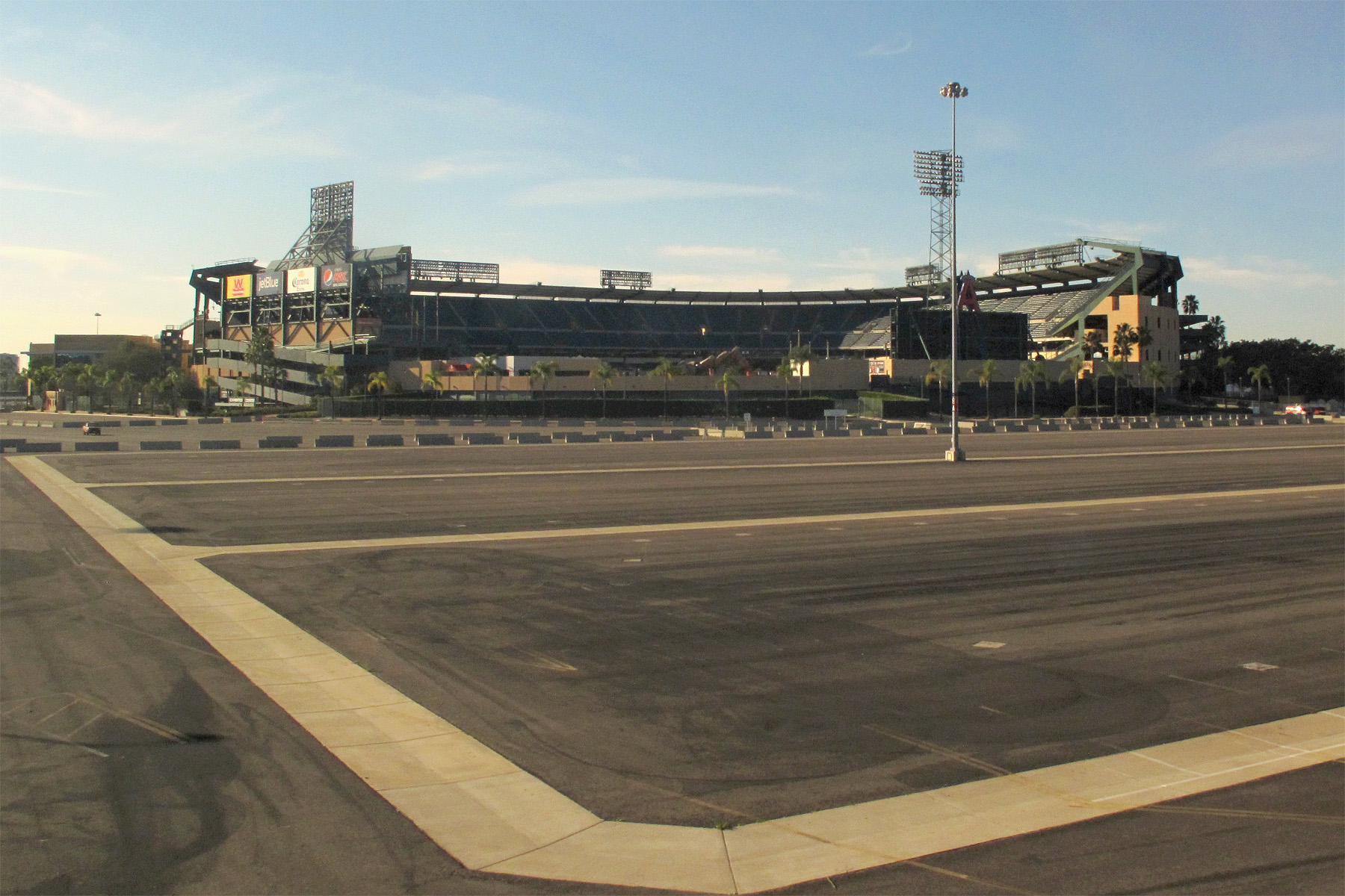
The Platinum Triangle occupies the southeast side of central Anaheim between the Santa Ana Freeway, the Santa Ana River, and Cerritos Avenue. Its identity comes from scale: Angel Stadium, Honda Center, broad arterials, rail infrastructure, large parking fields, and newer apartment buildings all sit within a landscape that was once dominated by warehouses and light industry. The city has planned the roughly 820-acre area as a high-density mixed-use district, so it remains visibly in transition rather than feeling like a finished downtown.
Angel Stadium opened in 1966 and remains the district's most recognizable landmark. The Big A sign rises over the parking area, while the ballpark's open outfield view connects the venue to the mountains on clear days. Honda Center, opened in 1993, hosts Ducks hockey, concerts, and major touring events. When both venues are active, the district can shift from quiet to crowded within an hour, changing traffic, sidewalk use, restaurant demand, and train ridership.
Transit and the river
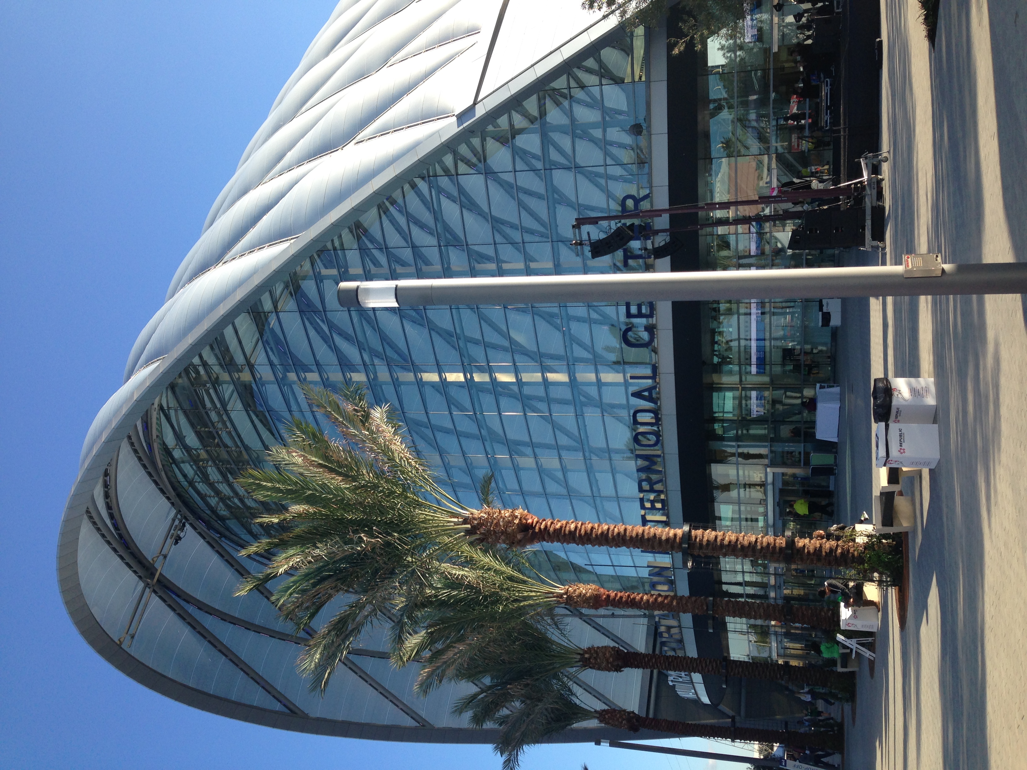
ARTIC—the Anaheim Regional Transportation Intermodal Center—sits between the venues with a distinctive arched exterior. It serves Amtrak Pacific Surfliner and Metrolink trains along with buses and event connections. For visitors coming from Los Angeles, Orange, Santa Ana, or San Diego County communities on the rail corridor, it can remove the hardest part of an event trip: entering and leaving a stadium parking lot with thousands of other cars. Service frequency varies, especially at night, so the return schedule should be checked before the event begins.
The Santa Ana River Trail traces the eastern edge and supplies a completely different view of the area. Cyclists and walkers can follow the paved corridor past the stadium zone toward Orange County communities and, over longer distances, the coast. Access points and construction conditions can change, but the trail shows why this district has long served transportation and industry: it sits in a broad, flat river corridor crossed by freeways, rail lines, and regional routes.
Living with redevelopment
New residential buildings have introduced balconies, courtyards, pools, and street-level businesses to blocks once defined by parking and loading docks. Yet gaps remain between projects, and the walking experience can change abruptly from landscaped frontage to wide roads or inactive industrial edges. That contrast is central to the Platinum Triangle today. It is not a historic neighborhood with a settled main street; it is Anaheim testing how to build a denser urban district around venues that were designed for cars.
Plan visits around the event calendar. On non-event mornings the area is useful for photographing architecture, riding the river trail, or reaching ARTIC without much friction. Before a game or concert, Katella Avenue, State College Boulevard, and nearby freeway ramps slow quickly. Rail, rideshare, and early arrival are practical alternatives. The neighborhood's future will continue to depend on stadium plans and phased development, but its present character is already distinct: sports energy, transit ambition, and new housing layered onto Anaheim's industrial east side.